Page 1 of 16 12311 ... LastLast
Results 1 to 15 of 227

Thread: Mandatory Evacuation Of New Orleans

  1. #1
    Join Date
    May 2004
    Location
    Milwaukee
    Posts
    6,542

    Mandatory Evacuation Of New Orleans

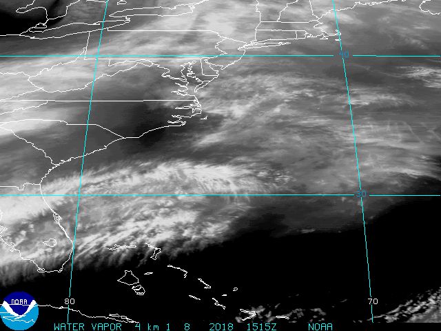
    Hurricane Katrina has reached status of Stage 5 hurricane and is building up strength in the Gulf of Mexico. The Mayor called for a mandatory evacuation of New Orleans; either flee or seek shelter at the Superdome. The city expects the city to be 30 feet underwater after the storm passes, and will be so for over a month. The city of New Orleans itself is below sea level. Here is a release from the Nat'l Weather Service

    URGENT - WEATHER MESSAGE
    NATIONAL WEATHER SERVICE NEW ORLEANS LA
    1011 AM CDT SUN AUG 28 2005

    ..DEVASTATING DAMAGE EXPECTED


    HURRICANE KATRINA
    A MOST POWERFUL HURRICANE WITH UNPRECEDENTED
    STRENGTH...RIVALING THE INTENSITY OF HURRICANE CAMILLE OF 1969.

    MOST OF THE AREA WILL BE UNINHABITABLE FOR WEEKS...PERHAPS LONGER. AT
    LEAST ONE HALF OF WELL CONSTRUCTED HOMES WILL HAVE ROOF AND WALL
    FAILURE. ALL GABLED ROOFS WILL FAIL...LEAVING THOSE HOMES SEVERELY
    DAMAGED OR DESTROYED.

    THE MAJORITY OF INDUSTRIAL BUILDINGS WILL BECOME NON FUNCTIONAL.
    PARTIAL TO COMPLETE WALL AND ROOF FAILURE IS EXPECTED. ALL WOOD
    FRAMED LOW RISING APARTMENT BUILDINGS WILL BE DESTROYED. CONCRETE
    BLOCK LOW RISE APARTMENTS WILL SUSTAIN MAJOR DAMAGE...INCLUDING SOME
    WALL AND ROOF FAILURE.

    HIGH RISE OFFICE AND APARTMENT BUILDINGS WILL SWAY DANGEROUSLY...A
    FEW TO THE POINT OF TOTAL COLLAPSE. ALL WINDOWS WILL BLOW OUT.

    AIRBORNE DEBRIS WILL BE WIDESPREAD...AND MAY INCLUDE HEAVY ITEMS SUCH
    AS HOUSEHOLD APPLIANCES AND EVEN LIGHT VEHICLES. SPORT UTILITY
    VEHICLES AND LIGHT TRUCKS WILL BE MOVED. THE BLOWN DEBRIS WILL CREATE
    ADDITIONAL DESTRUCTION. PERSONS...PETS...AND LIVESTOCK EXPOSED TO THE
    WINDS WILL FACE CERTAIN DEATH IF STRUCK.

    POWER OUTAGES WILL LAST FOR WEEKS...AS MOST POWER POLES WILL BE DOWN
    AND TRANSFORMERS DESTROYED. WATER SHORTAGES WILL MAKE HUMAN SUFFERING
    INCREDIBLE BY MODERN STANDARDS.

    THE VAST MAJORITY OF NATIVE TREES WILL BE SNAPPED OR UPROOTED. ONLY
    THE HEARTIEST WILL REMAIN STANDING...BUT BE TOTALLY DEFOLIATED. FEW
    CROPS WILL REMAIN. LIVESTOCK LEFT EXPOSED TO THE WINDS WILL BE
    KILLED.

    AN INLAND HURRICANE WIND WARNING IS ISSUED WHEN SUSTAINED WINDS NEAR
    HURRICANE FORCE...OR FREQUENT GUSTS AT OR ABOVE HURRICANE FORCE...ARE
    CERTAIN WITHIN THE NEXT 12 TO 24 HOURS.

    ONCE TROPICAL STORM AND HURRICANE FORCE WINDS ONSET...DO NOT VENTURE
    OUTSIDE!

    MSZ080>082-282100-
    HANCOCK-HARRISON-JACKSON-
    1011 AM CDT SUN AUG 28 2005
    http://hosted.ap.org/dynamic/files/s...r05/index.html


    I will keep you updated with maps and such.
    TOYNBEE IDEA IN KUBRICK 2001 RESURRECT DEAD ON PLANET JUPITER

  2. #2
    Join Date
    May 2004
    Location
    Northern New Jersey
    Posts
    16,602
    That's sad to hear..

    On a rather obnoxious note though, I've always wanted to be stuck in a level 5 hurricane.
    Rockefella says:
    pat's sister is hawt
    David Fiset says:
    so is mine
    David Fiset says:
    do want

  3. #3
    Join Date
    May 2004
    Location
    Milwaukee
    Posts
    6,542
    You wouldn't be able to watch it, I'm afraid. You're window would blow out. Guarenteed. And likely whatever structure you're wactching it from.
    TOYNBEE IDEA IN KUBRICK 2001 RESURRECT DEAD ON PLANET JUPITER

  4. #4
    Join Date
    Sep 2004
    Location
    land of the Desert Extreme Challenge Rally
    Posts
    5,499
    Holy ****

    Yes you would be able to be stuck in a Level 5 hurricane. The window blowing out, meaning you could see it with no glass interfereing...anyways....

    The newspaper over here hasn't even reported it....bastards - most of uae doesn't know what's going on

    I can only hope all UCP'ers and family are safe, my sympathy to the dead

  5. #5
    Join Date
    Apr 2003
    Location
    Knoxville, TN
    Posts
    1,218
    Oh wow, I had no idea it was going to be that bad. Good luck to anyone in New Orleans.

    That report is almost... Biblical.

  6. #6
    Join Date
    May 2004
    Location
    Northern New Jersey
    Posts
    16,602
    Quote Originally Posted by Esperante
    You wouldn't be able to watch it, I'm afraid. You're window would blow out. Guarenteed. And likely whatever structure you're wactching it from.
    Not watch it, I meant 'be in the middle of it'. Like fighting it on my own by grabbing on to trees and stuff. I'd prob. last 15 minutes before I died.
    Rockefella says:
    pat's sister is hawt
    David Fiset says:
    so is mine
    David Fiset says:
    do want

  7. #7
    Join Date
    May 2004
    Location
    Milwaukee
    Posts
    6,542
    Brace yourself, N.O....

    Some independent forecasters (meaning not Nat'l Weather Service) are predicting 200 mph winds once it reaches New Orleans. The Superdome, where I would guess thousands will be sleeping in when Katrina hits, was designed for 200.
    Last edited by Esperante; 08-28-2005 at 02:41 PM.
    TOYNBEE IDEA IN KUBRICK 2001 RESURRECT DEAD ON PLANET JUPITER

  8. #8
    Join Date
    May 2004
    Location
    Northern New Jersey
    Posts
    16,602
    Quote Originally Posted by Esperante
    Brace yourself, N.O....
    Cool GIF
    Hot damn.. I'm tempted to go down there.
    Rockefella says:
    pat's sister is hawt
    David Fiset says:
    so is mine
    David Fiset says:
    do want

  9. #9
    Join Date
    May 2004
    Location
    Milwaukee
    Posts
    6,542
    Hurricane Camille hit Louisiana at freak speeds in 1969...

    Experts predict Katrina will likely die down once it hits land and become a freak storm that would ride the East Coast up to about Nova Scotia where it would die.
    Last edited by Esperante; 08-28-2005 at 02:51 PM.
    TOYNBEE IDEA IN KUBRICK 2001 RESURRECT DEAD ON PLANET JUPITER

  10. #10
    Join Date
    Jul 2005
    Location
    Apalachin, New York
    Posts
    282
    New Orleans itself sits below sea level. This kind of storm could be utterly vicious. Hope for the best.

  11. #11
    Join Date
    May 2004
    Location
    Milwaukee
    Posts
    6,542
    Katrina hit up greater Miami pretty well, did some pretty good flooding...

    But this thing is just unfreakingbelievably huge. Look at the wind field distribution.
    TOYNBEE IDEA IN KUBRICK 2001 RESURRECT DEAD ON PLANET JUPITER

  12. #12
    Join Date
    May 2004
    Location
    Milwaukee
    Posts
    6,542

  13. #13
    Join Date
    May 2004
    Location
    Milwaukee
    Posts
    6,542
    New Orleans Braces for Powerful Katrina

    By ALLEN G. BREED
    Associated Press Writer

    NEW ORLEANS (AP) -- Monstrous Hurricane Katrina barreled toward the Big Easy on Sunday with 175-mph wind and a threat of a 28-foot storm surge, forcing a mandatory evacuation, a last-ditch Superdome shelter and prayers for those left to face the doomsday scenario this below-sea-level city has long dreaded.

    "Have God on your side, definitely have God on your side," Nancy Noble said as she sat with her puppy and three friends in six lanes of one-way traffic on gridlocked Interstate 10. "It's very frightening."

    Katrina intensified into a Category 5 giant over the warm water of the Gulf of Mexico on a path to come ashore early Monday in the heart of New Orleans. That would make it the city's first direct hit in 40 years and the most powerful storm ever to slam the city.

    "I'm really scared," resident Linda Young said as she fill her gas tank. "I've been through hurricanes, but this one scares me. I think everybody needs to get out."
    Rain began falling on southeastern Louisiana by midday Sunday, the first hints of a storm with a potential surge of 18 to 28 feet, topped with even higher waves, tornadoes and as much as 15 inches of rain.

    "We are facing a storm that most of us have long feared," Mayor Ray Nagin said in ordering the mandatory evacuation for his city of 485,000 people, surrounded by suburbs of a million more. "The storm surge will most likely topple our levee system."

    Conceding that as many as 100,000 inner-city residents didn't have the means to leave and an untold number of tourists were stranded by the closing of the airport, the city arranged buses to take people to 10 last-resort shelters, including the Superdome.

    Nagin also dispatched police and firefighters to rouse people out with sirens and bullhorns, and even gave them the authority to commandeer vehicles to aid in the evacuation.

    This is very serious, of the highest nature," the mayor said. "This is a once-in-a-lifetime event."

    For years, forecasters have warned of the nightmare scenario a big storm could bring to New Orleans, a bowl of a city that's up to 10 feet below sea level in spots and dependent on a network of levees, canals and pumps to keep dry. It's built between the half-mile-wide Mississippi River and Lake Pontchartrain, half the size of the state of Rhode Island.

    Estimates have been made of tens of thousands of deaths from flooding that could overrun the levees and turn New Orleans into a 30-foot-deep toxic lake filled with chemicals and petroleum from refineries, and waste from ruined septic systems.

    Katrina's eye was expected to make landfall around sunrise Monday on the southeastern Louisiana coast, although Mississippi also was in danger, said Ed Rappaport, deputy director of the National Hurricane Center in Miami. Because Katrina was such a big storm with hurricane-force wind of at least 74 mph extending up to 105 miles from the center, areas far from the eye's landfall could still be devastated.

    At 2 p.m. EDT, Katrina's eye was about 180 miles south-southeast of the mouth of the Mississippi River. The storm was moving toward the west-northwest at nearly 13 mph and was expected to turn toward the north-northwest.

    A hurricane warning was in effect for the north-central Gulf Coast from Morgan City, La., to the Alabama-Florida line, the hurricane center said. Tropical storm warnings extended east to Indian Pass, Fla., and west to Cameron, La., a spread of about 480 miles.

    Despite the dire predictions, a group of residents in a poor neighborhood of central New Orleans sat on a porch with no car, no way out and, surprisingly, no fear.

    "We're not evacuating," said 57-year-old Julie Paul. "None of us have any place to go. We're counting on the Superdome. That's our lifesaver."

    The Superdome, the 70,000-seat home of football's Saints and the New Year's Sugar Bowl, opened at daybreak Sunday, giving first priority to frail, elderly people on walkers, some with oxygen tanks. They were told to bring enough food, water and medicine to last up to five days.

    In the French Quarter, most bars that stayed open through the threat of past hurricanes were boarded up and the few people on the streets were battening down their businesses and getting out.

    Sasha Gayer tried to get a train out of town but couldn't. So she walked back to the French Quarter, buying supplies on the way, and then stopped at one of the few bars open on Bourbon Street.

    "This is a lot more fun than sitting at home listening to apocalyptic media reports," she said. "This is how you know it's a serious hurricane. You can't find a slice of white bread in the city, but you can still buy beer."

    Airport Holiday Inn manager Joyce Tillis spent the morning calling her 140 guests to tell them about the evacuation order. Tillis, who lives inside the flood zone, also called her three daughters to tell them to get out.

    "If I'm stuck, I'm stuck," Tillis said. "I'd rather save my second generation if I can."

    But the evacuation was slow going. Highways in Louisiana and Mississippi were jammed as people headed away from Katrina's expected landfall. All lanes were limited to northbound traffic on Interstates 55 and 59, and westbound on I-10.

    Katrina was "unmitigated bad news" for motorists across the nation because it shut down offshore production of at least 1 million barrels of oil daily and threatened refinery and import operations around New Orleans, said oil analyst Peter Beutel. He predicted crude oil could top $70 a barrel by Monday or Tuesday.

    Hotels were spared from evacuation orders to give tourists and locals a place for "vertical evacuation."

    Tina and Bryan Steven, a couple from Forest Lake, Minn., who came to attend a conference of emergency medical services, sat glumly on the sidewalk outside their hotel in the French Quarter.

    "We're choosing the best of two evils," said Bryan Steven. "It's either be stuck in the hotel or stuck on the road. ... We'll make it through it."

    His wife, wearing a Bourbon Street T-shirt with a lewd message, interjected: "I just don't want to die in this shirt."

    Only three Category 5 hurricanes - the highest on the Saffir-Simpson scale - have hit the United States since record-keeping began. The last was 1992's Hurricane Andrew, which at 165-mph leveled parts of South Florida, killed 43 people and caused $31 billion in damage.

    New Orleans has not taken a major direct hit from a hurricane since Betsy in 1965, when an 8- to 10-foot storm surge submerged parts of the city in seven feet of water. Betsy, a Category 3 storm, was blamed for 74 deaths in Louisiana, Mississippi and Florida.

    Rappaport warned that Katrina, already responsible for nine deaths in South Florida as a mere Category 1, could be far worse for New Orleans.

    "It would be the strongest we've had in recorded history there," Rappaport said. "We're hoping of course there'll be a slight tapering off at least of the winds, but we can't plan on that. ... We're in for some trouble here no matter what."

    ...........................

    Essentially, the US is looking at it's own share of tsunami style damage.
    TOYNBEE IDEA IN KUBRICK 2001 RESURRECT DEAD ON PLANET JUPITER

  14. #14
    Join Date
    Dec 2004
    Posts
    5,606
    Quote Originally Posted by Rockefella
    Hot damn.. I'm tempted to go down there.
    lol, you have wierd issues dude.
    "The thunder of 1001bhp would send a sonic boom through his carbon fibre shell, crack it in half and leave a wet puddle on the fancy leather seat."

  15. #15
    Join Date
    May 2004
    Location
    Milwaukee
    Posts
    6,542
    Picture from earlier today...

    As of 5:50 Eastern Time...

    Oh snap.
    Last edited by Esperante; 08-28-2005 at 03:01 PM.
    TOYNBEE IDEA IN KUBRICK 2001 RESURRECT DEAD ON PLANET JUPITER

Thread Information

Users Browsing this Thread

There are currently 1 users browsing this thread. (0 members and 1 guests)

Posting Permissions

  • You may not post new threads
  • You may not post replies
  • You may not post attachments
  • You may not edit your posts
  •